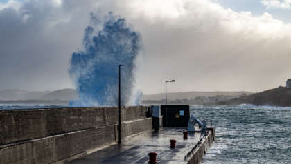
Storm Agnes is expected to hit Ireland tomorrow, with disruptions expected in certain places.
Met Éireann have warned that spot flooding is expected in some areas, following outbreaks of heavy rain. It is also expected to become extremely windy or stormy in the east, with some severe or damaging gusts of wind expected for the south.
These winds will come from Belfast Lough to Carnsore Point, to Valentia and the Irish Sea.
The national forecaster has also confirmed that a Status Yellow warning has also been issued, along with rain warnings from 7am.
With the wind alert put in place for Leinster and Munster, a rain warning has been placed for 8 counties across Ireland. Taking effect from 7am, these counties include Carlow, Dublin, Kilkenny, Wexford, Wicklow, Cork, Kerry and Waterford.
Treacherous conditions may lead to difficult travel conditions, fallen trees, poor visibility, coastal flooding, power outages, and coastal flooding.
A Status Yellow Wind warning has also been issued for Northern Ireland, taking effect from 12pm tomorrow until 7am. Met Office spokesperson Stephen Dixon said that Northern Ireland "could see in excess of 30mm of rainfall in a relatively short period of time".
Met Éireann have also warned that these winds could reach storm force 10 at times.
#StormAgnes has been named by the UK Met office for Wednesday. It is the first named storm of the season.
— Met Éireann (@MetEireann) September 25, 2023
At the moment we have yellow wind & rain warnings in place.🍃🌧️
Please keep an eye on ➡️https://t.co/juduxcKda8⚠️ for any updates pic.twitter.com/bx5QovEm2W


 Ireland's Classic Hits Radio scoops multiple awards at the 2024 IMRO Radio Awards.